Big Sur Itinerary: The Best California Road Trip
The BEST California road trip you could ever do is driving the Big Sur and I have the ultimate Big Sur Itinerary for you with all the best scenic spots to stop at along the way!
The Big Sur is a famous strip of the California Highway along the Pacific Ocean. It’s been mentioned as one of the most scenic drives along the California coast and is one of the top tourist destinations in the world.
My Santa Barbara Experience
My friend and I hired a car from Dollar Car Hire in Los Angeles where we started our road trip and dropped the car off in San Francisco where our road trip ended. The price was reasonable, we paid AUD 300 for renting the car for 6 days!
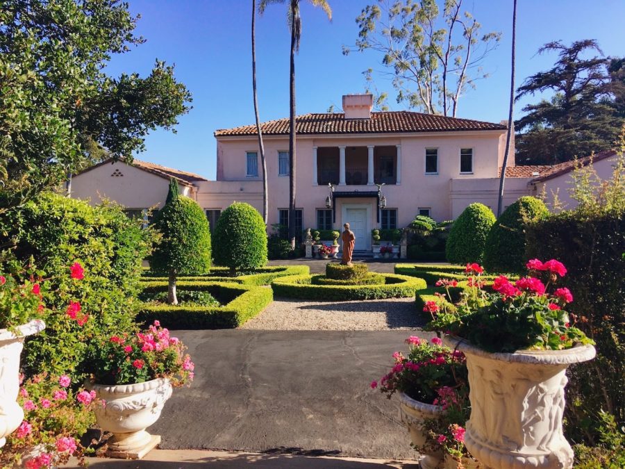
From Los Angeles, we made our way to Santa Barbara which is about an hour and a half drive where we stayed for one night at my friend’s family’s mansion.
Along the way, we picked up supplies from Walmart for our road trip: pillows, blankets, water, and food (food we didn’t need to put in a fridge or cook).
Considering the super GHETTO road trip we were going to embark on, this mansion probably should have been something we ended on not started with.
All I could think about while I was sleeping in the car those next 4 nights on our road trip was how I wish I was sleeping in the African-themed room at my friend’s family’s mansion.
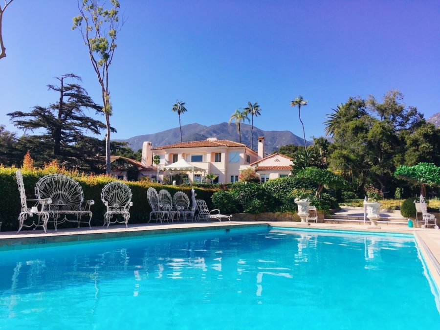
Oh and the dinner at that place was definitely food we would not be eating on our road trip – sausages, jacket potatoes, cooked vegetables, and even homemade sticky date pudding for dessert!
I remember feeling super-rich seated at the dining room table with a water fountain in the middle and about 5 different knives and forks next to my plate.
The day after visiting the Coral Casino Club (which is only a private club for the rich) in Montecito we began our road trip to Big Sur from Santa Barbara.
Big Sur Itinerary
Day 1: Santa Barbara to Morro Bay
Stop 1 – Solvang
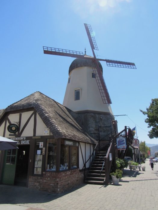
We drove for about 50 minutes until we reached the first stop on our road trip, a cute little Danish town named Solvang. Solvang is well known for its Danish architecture and wineries.
Mission Drive, the main street in town is lined with Danish-themed souvenir shops that sell authentic gifts like wooden shoes and cuckoo clocks.
Pick up a walking map of the town from the Visitor Center located on Copenhagen Drive. The map provides points of interest such as the big red clogs outside the Solvang Shoe Store, the Little Mermaid statue, and the windmill.
Stop 2 – Pismo Beach
From Solvang, the drive to Pismo Beach is about 50 minutes.
The beach is BEAUTIFUL with its sandy beach and blue ocean water. It’s a great spot to get out and stretch your legs and maybe even go for a walk along the beach.
Stop 3 – Morro Bay
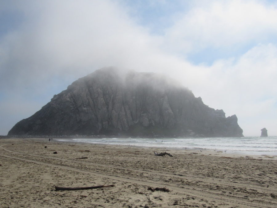
The last stop for the day is only a half an hour drive to Morro Bay. Morro Bay is known for Morro Rock an ancient volcanic mound at the end of Morro Rock Beach.
The sandy beach with this volcano rock in the background makes for a great photo opportunity!
The accommodation around here is pretty expensive so if you are on a budget you could do what we did and find a spot along the coast and sleep in the car.
There are plenty of places to sleep in your car along the California Coast and it’s also pretty safe to do. Most of the time we slept in the car it was overlooking a beach! A beautiful sight to wake up to!
Day 2: Morro Bay to Sand Dollar Beach
Stop 4 – Hearst Castle
Hearst Castle is a 35-minute drive on Highway 1 from Morro Bay. This was one of my favourite stops on our road trip and a must-see on your Big Sur Itinerary!
A tour of Hearst Castle will cost $25 US and it’s worth it because you learn so much and see things that you wouldn’t be able to without taking the tour.
Hearst Castle is nestled in the hills above the village of San Simeon. If you love history and art then you’ll want to check this place out!
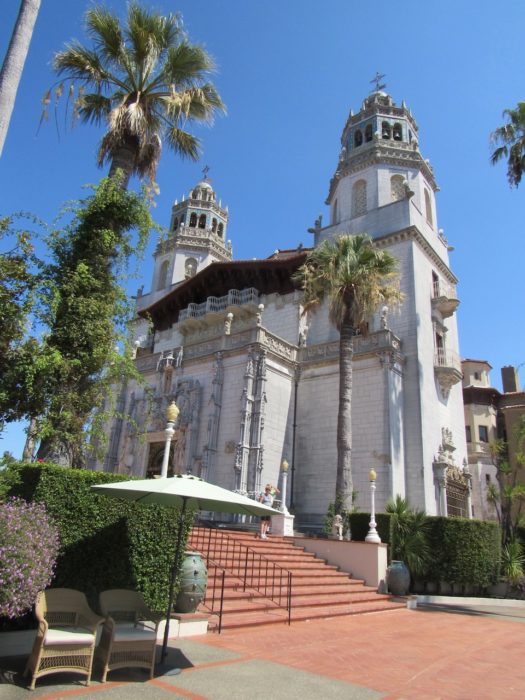
The tours take you around the castle grounds and to the castle’s two luxury pools. The Neptune Pool outside was under construction when I visited so I was disappointed I couldn’t see it. I had seen photos of it and it looked amazing!
We did however get to see the indoor Roman Baths and this was the highlight of the tour! The attention to detail and the mosaic tiles with the blue and gold theme made it look incredibly lavish!
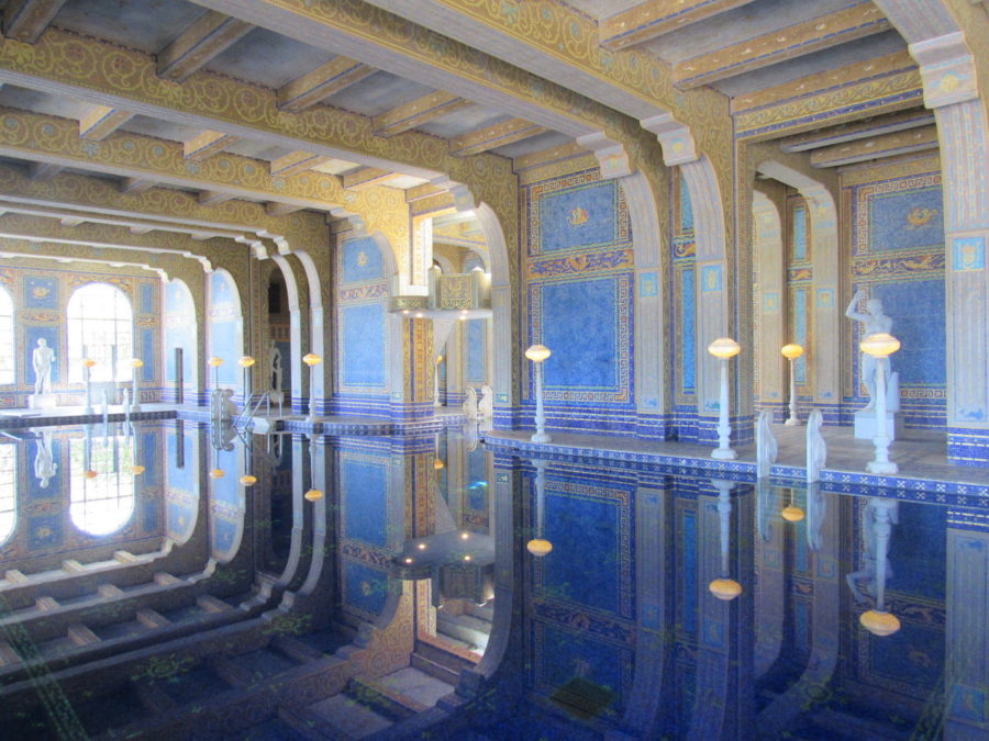
After the castle, we drove down the hill and ate lunch at the pier with amazing views of the ocean!
Stop 5 – Sand Dollar Beach
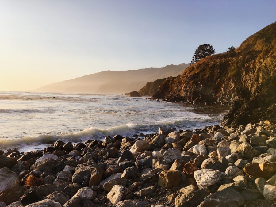
A 45-minute drive on Highway 1 from Hearst Castle is Sand Dollar Beach. A perfect place to eat dinner while watching the sunset over the ocean.
Sand Dollar Beach is the LARGEST sandy beach in Big Sur! Keep in mind that there is a $10 US parking fee and it’s cash only so make sure to bring some cash with you!
Day 3: Sand Dollar Beach to Point Lobos State Natural Reserve
At the time of planning our road trip, we did not know that part of Highway 1 was closed due to Pfeiffer Canyon Bridge collapsing from a landslide. What should have taken us a quick half an hour drive to get to Julia Pfeiffer Burns State Park turned into 4 hours of driving around to get back on Highway 1.
Not only did it take so much time out of our day but we had to take a detour on Nacimiento – Fergusson Road.
Nacimiento – Fergusson Road is a narrow dirt road with many tight and sharp corners. You have to beep around every corner and pray that you aren’t just about to have a head-on collision. It was also sunny and bright outside which made our visibility very low.
This dangerous road is steep and had drops at almost every turn without any guard rails. The only good thing about driving on this road was the views!
Stop 6 – Mcway Falls, Julia Pfeiffer Burns State Park
One of the most popular stops on Big Sur is Julia Pfeiffer Burns State Park a half an hour drive on Highway 1 from Sand Dollar Beach.
The main tourist attraction in this park is Mcway Falls which is a gorgeous 80-foot tall waterfall that drops over a cliff into the Pacific Ocean.
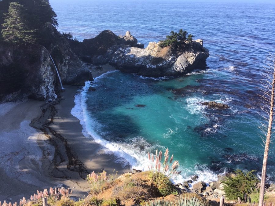
Walk the Waterfall Overlook Trail for an amazing view overlooking the falls and beach! It is an easy flat 1.8km roundtrip walk. This is a must-see on your Big Sur itinerary, it’s truly breathtaking!
Due to the road being closed we did miss out on a couple of stops we were going to make as we had no way of getting to them. The stops we skipped were Limekiln State Park (where there are old ruins and falls) and Tassajara Hot Springs!
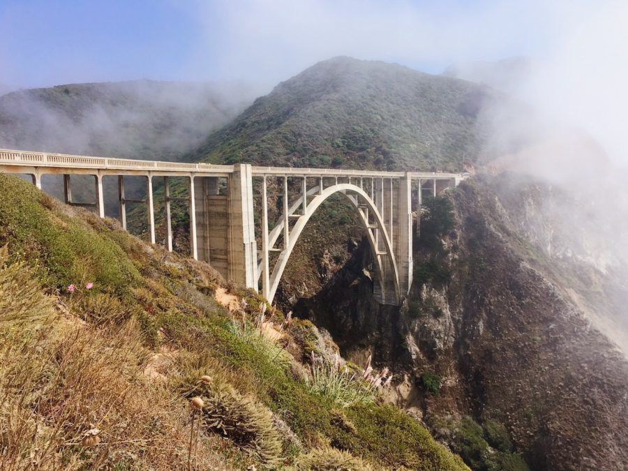
Stop 7 – Bixby Bridge
As we lost a lot of time from the detour we didn’t have the time to stop at Pfeiffer Beach and the Big Sur Trailhead. We decided to drive to Point Sur Lighthouse. For some reason, the Point Sur Lighthouse was closed the day we went. We really didn’t have much luck on this road trip!
Disappointed with the fact that we couldn’t see everything we had planned to we didn’t let it ruin our road trip.
Bixby Bridge is a 40-minute drive from Mcway Falls. Plenty of stops available on the side of the road to take photos or just to enjoy the stunning view.
Bixby Bridge is a popular and busy photo spot, full of tourists. There are lots of spots on the side of the road to park but it’s usually packed so you may have to wait for a spot.
The bridge is one of the most photographed bridges in California because of its amazing architecture and location!
Stop 8 – Point Lobos State Natural Reserve
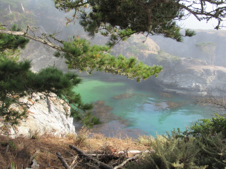
It was late afternoon by the time we got to Point Lobos State Natural Reserve a 20-minute drive from Bixby Bridge. The weather was overcast so we didn’t have a clear view of the Reserve but I can imagine it being beautiful when it’s sunny!
To enter and park your car at Point Lobos State Natural Reserve there is a fee of $10 US. They only accept cash! It’s best to carry some cash on your road trip as there aren’t any easily accessible ATMs around, especially because most of these stops are far from town.
There are many trails to do at Point Lobos State Natural Reserve with coastal views and tide pools. You could spend hours here!
Day 4: Monterey Bay to Half Moon Bay
Stop 9 – Monterey Bay
There is much to do at Monterey Bay including an aquarium, beaches, lookout points, and an Old Fisherman’s Wharf. We had our first proper meal in days at the Old Fisherman’s Wharf. Fish and chips never tasted so good!
The free trolley shuttle is the best way to get around and see the town. The route stops at Downtown Monterey, Fisherman’s Wharf, Cannery Row, and the Monterey Bay Aquarium. Look out for the green MST Trolley signs to board the trolley.
It operates daily in the summer months and weekends during the off-season and runs every 10 to 15 minutes from 10 am to 7 pm.
Stop 10 – Shark Fin Cove
After enjoying some civilization at Monterey Bay we drove for an hour to Shark Fin Cove. On the way, we made a stop at the Santa Cruz Boardwalk!
It’s 50 minutes from Monterey and 20 minutes to Shark Fin Cove. Lots to see and activities to do near the boardwalk if you have the time! There is even an Amusement Park here!
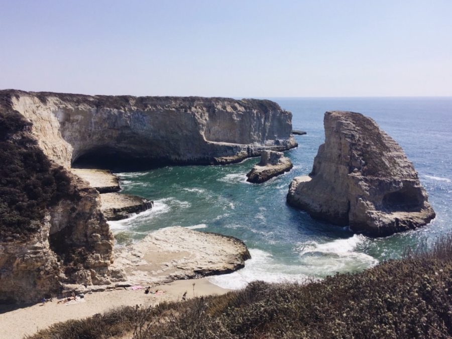
There aren’t any signs indicating where Shark Fin Cove is and it can be easily missed hence why it’s not as popular. Type Shark Fin Cove in Google Maps and that will lead you there.
There isn’t a parking lot but you can park on the side of the road. Take the path away from the road (Sea Cave Trail) for a view of the cove from above.
It’s called Shark Fin Cove because of the rock that looks like a shark fin coming out of the water off the shore. You can climb down the rocks to get to the beach for a swim and see the large sea cave on the left. It is the perfect place for a swim on a summer’s day!
Stop 11 – Pigeon Point Lighthouse
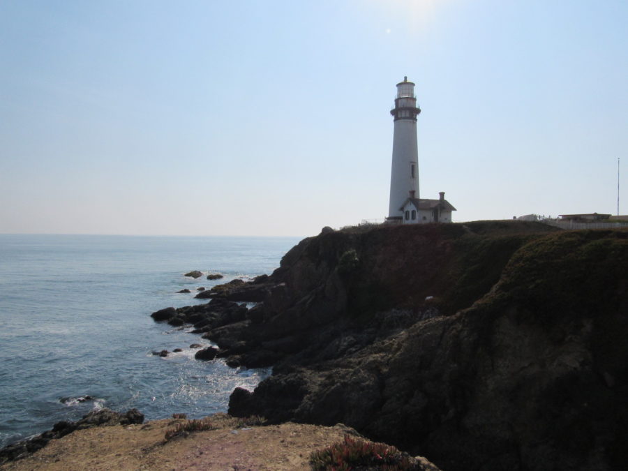
Another great stop along Highway 1 is Pigeon Point Lighthouse 50 minutes from Shark Fin Cove! It’s an awesome lighthouse right beside the ocean!
Pigeon Point Lighthouse is the TALLEST lighthouse on the West Coast of the United States.
Stop 12 – Half Moon Bay
Half Moon Bay was the perfect end to our road trip! A 25-minute drive from Pigeon Point Lighthouse is the Half Moon Bay Coastal Trail.
Half Moon Bay was the last stop on our Big Sur Drive and the next morning we headed to San Francisco which was a short 40-minute drive.
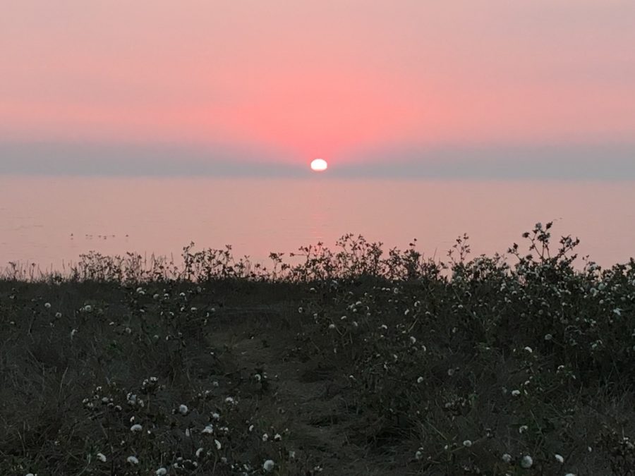
I loved every road stop we made and I would not have changed a thing about our Big Sur Itinerary! There is so much to see and do along the California Coast. The above Big Sur itinerary will have you stopping at all the best and most famous places!
like this website? Get it on thestartupmarket.com
T & C'S
privacy policy
contact
customised Itineraries
shop
blog
about